
A short but demanding hike with one of the Stirling Range’s most impressive summits. Take on Mount Talyuberlup and you’ll be rewarded with spectacular panoramic views of the surrounding peaks of the Stirling Range. Talyuberlup Peak also has some unique features such as a huge rock cave and a massive rock cairn on the summit. The Talyuberlup Peak hike is a memorable one that will exceed your expectations.
We’ve put together this guide to let you know everything you need to know about the Mount Talyuberlup Peak trail. We go into details on everything such as; how long the Talyuberlup Peak hike is, how hard the Talyuberlup Peak hike is, the best time to complete the Talyuberlup Peak hike, how much the Talyuberlup Peak hike costs, and what facilities are at Talyuberlup Peak. Keep reading so that you can fully prepare yourself to take on the Mount Talyuberlup Hike.
How Long is the Talyuberlup Peak Hike?
The full Talyuberlup Peak hike is approximately 2.6km return.
How Long Does it Take to Complete the Talyuberlup Peak Hike?
The full Talyuberlup Peak return hike takes around 3 hours. The time it takes will depend on how long you spend on the summit, how often you stop to rest or take photos and your fitness level.
How High is Talyuberlup Peak?
Talyuberlup Peak has a height of 783 metres above sea level.

What Grade is the Talyuberlup Peak Hike?
Talyuberlup Peak is classified as a grade 5 hike. A grade 5 hike is only recommended for very experienced bushwalkers as grade 5 trails can be long, unmarked, very rough and very steep. They also may require rock scrambling.
How Hard is it to Hike Talyuberlup Peak?
The Talyuberlup Peak is classified as difficult as it’s a very steep trail that requires rock scrambling over large rugged rocks. You will also have to hike up loose rock on a very steep path, which on the return is particularly demanding on your joints as you are careful not to slip.
A short but demanding track, Talyuberlup Peak is one of the more difficult hikes of the Stirling Ranges. Being frequent hikers and having completed all of the other mountain hikes in the Stirling Ranges we found Talyuberlup Peak a fun challenge. Definitely not an easy feat but a very achievable one, just listen to your body and take the trail at a pace that suits you.


Can Anyone Hike Talyuberlup Peak?
Yes, despite being a challenging hike anyone with a moderate to high level of fitness and agility can take on the trail and do the Talyuberlup Peak hike. You just need to know your own limits and take your time, taking the trail at a pace that suits you.
Can Kids Climb Talyuberlup Peak?
As a challenging and demanding hike the Tayluberlup Peak trail is not suitable for young kids. The hike would only be suitable for older kids who have experience hiking and are comfortable taking on difficult trails.
Can Elderly People Climb Talyuberlup Peak?
Yes, older people can climb Talyuberlup Peak. However as a challenging and demanding hike you will need to have a high level of fitness and agility. As discussed previously, you will also have to hike up loose rock on a very steep path, which on the return is particularly demanding on your joints. Therefore, the trail would not be suitable if you have knee or leg issues.
Know your own limits and listen to your body.
Can you do the Talyuberlup Peak Hike Solo?
Yes the Talyuberlup Peak trail can be done solo. When taking on a hike alone always make sure to let someone else know of your whereabouts and approximately how long you think the trail is going to take.
When is the Best Time of Year to do the Talyuberlup Peak Trail?
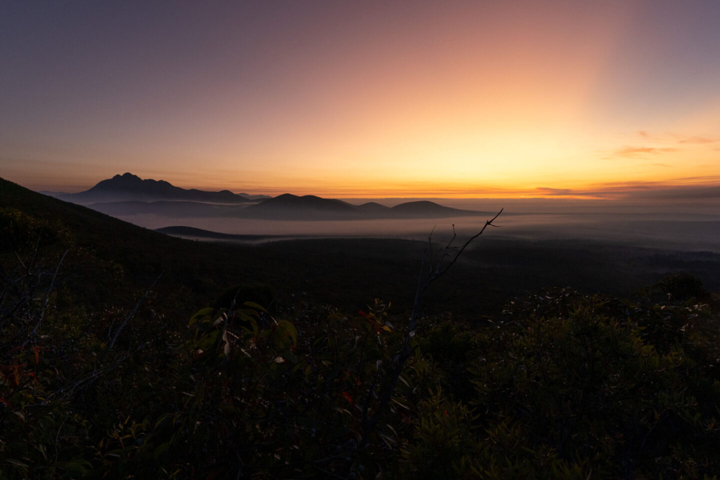
The Talyuberlup Peak hike can be done all year round. The best time of year to complete the hike is during spring (September-November) as the spring months typically have the best weather conditions as you’ll avoid the intense heat that summer brings and the rain and wind of the winter months. Spring is also when the Stirling Range National Park comes alive with wildflowers.
With that being said, we completed the hike during summer in January and the conditions were perfect as we started the hike early in the morning to avoid the heat. We also still saw some wildflowers.


What is the Best Time to Hike Talyuberlup Peak?
You can do the Talyuberlup Peak at any time. The best time to start will depend on what month you’re visiting. You’ll want to do the hike when it’s cooler but you still have great visibility.
If you’re taking on the hike during Summer we’d recommend starting the hike early in the morning just after sunrise to avoid the intense summer heat that hits by midday.
Sunrise and sunset hikes are very popular for the Stirling Ranges as they provide incredible views. However, the Talyuberlup Peak path can be dangerous outside of daylight hours as it’s steep and rough so we’d only recommend taking on the hike at sunrise or sunset if you have prior experience doing so.

What Should I Expect on the Talyuberlup Peak Hike?
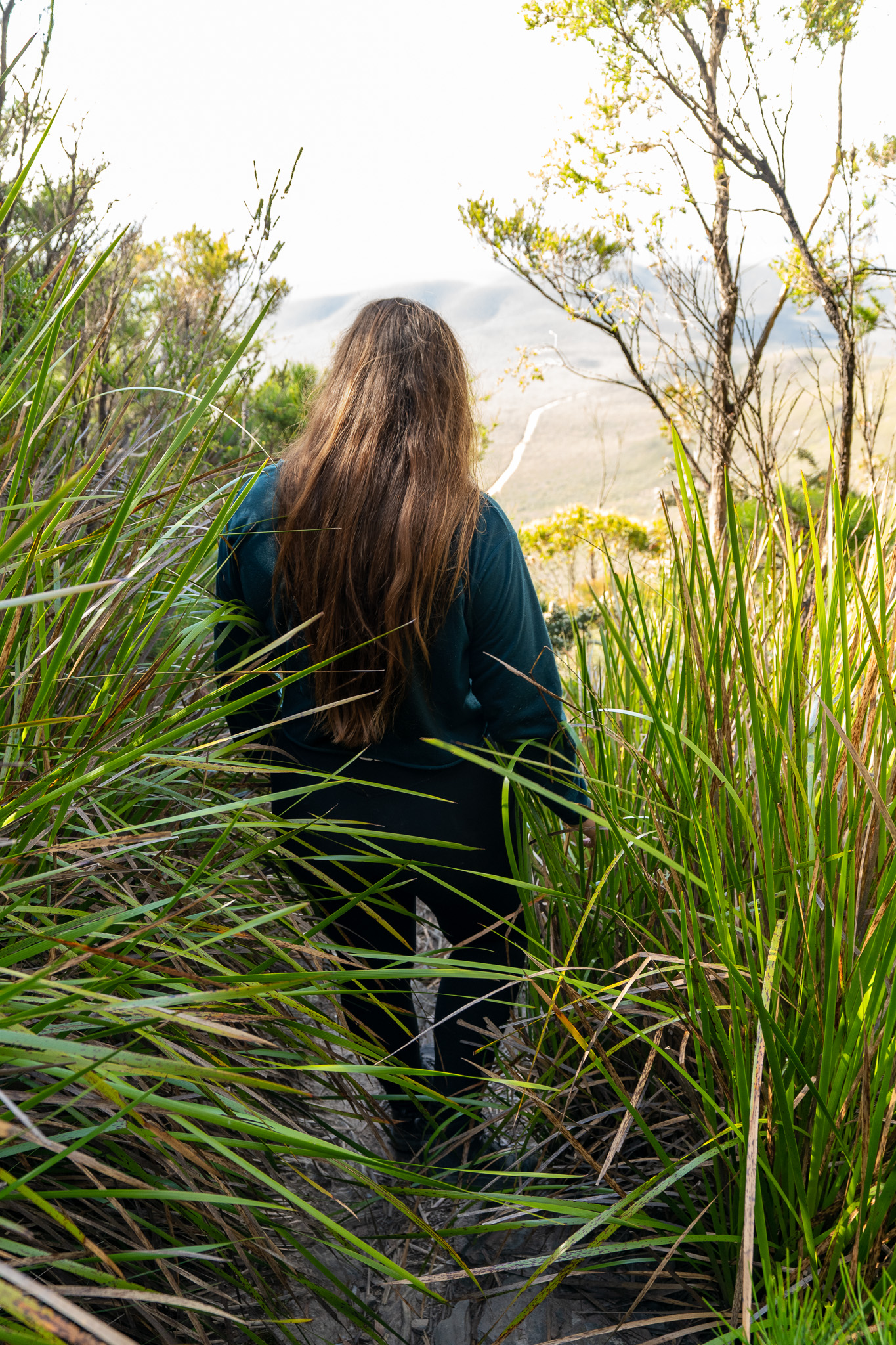
Expect a demanding but rewarding hike up Talyuberlup Peak with stunning summit views and a large cave near the top. Starting as a flat dirt path through skinny trees, the trail starts off easy but quickly turns into a very steep incline up loose rock.


You’ll continue up the steep path of loose rock for what feels like ages until you start to reach the rock face of the mountain. The path becomes skinnier and turns to rocky steps that require some scrambling.

Eventually you reach a huge cave, the roof of which looms over you. As you stop to stare and take in the impressive size of the cave you’ll notice a sign inside that warns you of rockfall and tells you not to stop under the rock overhang. Continue on from this section and you’ll face some steep rock scrambling before the summit.

As soon as you reach the summit you’ll be greeted by a very impressive rock cairn. Make sure to add your own rock to the pile here and take some time to explore and appreciate the summit. The summit is relatively large giving you a lot of space to explore, whether that’s wandering the summit spotting the many skinks who live there or walking around the summit admiring the 360 degree spectacular views of the surrounding peaks of the Stirling Range. Enjoy, catch your breath and prepare for the journey down.


How Much does it Cost to Hike Talyuberlup Peak?
Talyuberlup Peak is within the Stirling Range National Park which has park entry fees. At the time of writing this (February 2023) the price is $15 per standard vehicle (with 12 or less occupants).
If you’re visiting multiple national parks during your trip we would recommend getting a holiday pass or an annual all parks pass as these will be better value for money. Holiday passes are available for 5 days, 14 days or 4 weeks and annual all parks passes are available for a full year. You can buy these online (here) on the Department of Biodiversity, Conservation and Attractions website.
Are there Toilets at Talyuberlup Peak?
No, there are no toilets at the Talyuberlup Peak trail. The nearest toilets are at the Bluff Knoll car park which is a 35 minute drive away from the Talyuberlup Peak car park.
What Facilities are at Talyuberlup Peak?
Talyuberlup Peak does not have many facilities, it only has a small picnic area which has a single picnic bench. If you’ve packed food you can enjoy this in the picnic area before or after your hike.

Do you Need a Map for the Talyuberlup Peak Trail?
No you don’t need a map as the Talyuberlup Peak trail is easy to navigate. The path is relatively clear making it obvious where to go. There are also trail markers throughout the trail letting you know you’re on the right track.
As you get higher up and onto the section of rock scrambling the path becomes a lot less clear. However as soon as you doubt where you’re going you usually spot a trail marker off in the distance and it once again becomes obvious where to go.


Is Talyuberlup Peak Dog Friendly?
No, dogs (and all other pets) are not allowed in the Stirling Range National Park. Unfortunately you’ll have to leave your furry friend at home.
Is there Phone Reception at Talyuberlup Peak?
Yes there is. We had perfect Telstra signal in the car park, on the trail and at the summit.
Is the Road to Talyuberlup Peak Sealed?
No, Stirling Range Drive (the road that leads up to the Talyuberlup Peak car park) is an unsealed dirt road. The car park itself is also unsealed. We were fine driving on Stirling Range Drive in our 2WD Mercedes Sprinter however some areas were pretty rough and corrugated so just make sure to take it slowly.
Also just to note that we spotted a lot of wildlife while driving on Stirling Range Drive at dusk and dawn so make sure to stay alert and drive slowly.

Is there Parking at Talyuberlup Peak?
Yes there’s an unsealed car park at the base of Talyuberlup Peak where the trail starts. The car park does not have marked parking spots but would fit about 8 cars. The parking area is relatively long so our LWB Mercedes Sprinter van was able to fit just fine (as shown in the photo below).

Where is Talyuberlup Peak?
Talyuberlup Peak is located in the Stirling Range National Park in the Great Southern region of Western Australia.
How do you Get to Talyuberlup Peak?
There is no public transport nearby so you will need to drive to get to Talyuberlup Peak. The trail starts just off the Mount Talyuberlup carpark so make sure to navigate to ‘Mount Talyuberlup Walk Carpark’ in Google Maps (link is here). Navigating to ‘Talyuberlup Peak’ would try and navigate you to the summit.
How Far is Talyuberlup Peak from Perth?
Talyuberlup Peak is approximately 385km from Perth, which is about a 4.5-5 hour drive away (depending on traffic and which route you take).
How Far is Talyuberlup Peak from Albany?
Talyuberlup Peak is approximately 98km from Albany, which is about a 1-1.5 hour drive away (depending on traffic and which route you take).
Where does the Talyuberlup Peak Trail Start?
The trail starts close to the Talyuberlup Peak car park. Once you arrive at the car park you’ll see the trail information sign and trail start in a small clearing of trees opposite and to the right of the Talyuberlup car park.
The Talyuberlup car park sign is shown in the image below. You can see the trail start and trail information sign off in the distance behind it.

What Should you Pack When Hiking Talyuberlup Peak?
We recommend packing the following for the Talyuberlup Peak trail:
- Water – take at least 1L per person per hour.
- Snacks – pack snacks in case you want to ‘refuel’ along the way.
- A first aid kit – we always recommend packing a small first aid kit with some basic supplies, no matter the length or difficulty of the hike.
- A hat – stay sun smart and protect your face, head, neck and ears with a hat.
- Sunscreen – protect yourself and stay sun smart.
- A camera – pack your camera or phone to take pictures of the incredible views at the summit of Talyuberlup Peak.
What Should you Wear When Hiking Talyuberlup Peak?
Wear comfortable clothes that are suitable for hiking in. Make sure your clothes are flexible so you’re not limited in the rock scramble and steeper areas where you’ll need to stretch more. The Stirling Range is also known for sudden weather changes so we would recommend wearing multiple layers that can be adjusted as the weather changes. Some sections of the trail are overgrown so we’d recommend longer clothing so you don’t get scratched by the leaves and twigs.
As with any hike make sure to be sun smart; wear a hat, cover up and put sunscreen on. Also wear sturdy and comfortable footwear, such as trainers or hiking boots. Ensure your shoes have good grip so you are sturdy hiking on the loose rock and rock scramble.

Are there any Other Trails near Talyuberlup Peak?
Yes there are loads of other trails near Talyuberlup Peak if you’re looking for another hike to conquer.
The Stirling Range has five other spectacular mountain trails, each of which are very different. The five other mountain trails are; Bluff Knoll, Toolbrunup Peak, Mount Magog, Mount Hassell hike and Mount Trio. If you have the time we’d definitely recommend taking on a couple of the mountain trails while in the area.
The Porongurup Range is another mountain range that lies just 30 minutes South of the Stirling Range. The Porongurup Range has some equally-incredible hikes such as the Castle Rock Granite Skywalk trail and the Nancy Peak and Devils Slide hike.


Enjoy the Talyuberlup Peak Hike!
That’s the end of our guide on everything you need to know about the Talyuberlup Peak trail. We hope you enjoy the hike and the amazing views at the summit.
Watch Our Experience Doing the Talyuberlup Peak Hike
If you’re interested you can watch our experience doing the Talyuberlup Peak hike in our YouTube video below when we took on the Talyuberlup Peak hike and the Mount Magog hike as part of our ‘hiking 4 mountains in 48 hours’ challenge.

Hey! I’m Lydia and I have been travelling full time with Wehan since 2022. Alongside documenting our travels on YouTube, we put together comprehensive travel guides on the locations we visit here on our website. We also put together guides on other aspects of our travels, such as detailed information on the gear we use, specifics on our van build and tips for van life. Our goal with this website and the guides we write is to help others travel.
At the moment we are currently doing the big lap of Australia in our self converted Sprinter van. Our goal is to continue to push ourselves outside our comfort zone; seeking new adventures, learning about new cultures and seeing as much of the world as possible.
